For several years, discussions in the oil and gas industry have alluded to the similarities of reservoir and channel systems of the Teak and Jubilee discoveries in Ghana, and compared these with the success of the Zaedyus discovery in French Guiana. In a recent edition of First Break, EMGS geoscientists used multi-client 3D CSEM data and 2D seismic grid to discuss how regional CSEM data integrated with seismic in deepwater exploration can be a powerful tool for investigating fluid properties in reservoir sections.

In the April edition of First Break, Håkon T. Pedersen and Mike Hiner co-authored the article “Channel play in Foz do Amazonas—exploration and reserve estimate using regional 3D CSEM”.
Focus on turbidite systems on trend with Zaedyus discovery
Pedersen and Hiner presented acquisition play concepts for exploration in frontier regions. The program focused on turbidite systems of the Foz do Amazonas basin which are on trend with the Zaedyus discovery in French Guiana.
According to the authors, the Zaedyus discovery which is approximately 50 km northwest of the Foz do Amazonas trend, provides supporting evidence for a working petroleum system in the region. The proximity of this younger channel play to Zaedyus indicates that there is a working petroleum system.
Moreover, existence of hydrocarbons in the geologic system allows for the possibility of having viable economic oil accumulations in younger turbidite reservoirs in the upper Cretaceous and Tertiary.
Younger channel plays – well within CSEM detection window
The geoscientists from EMGS independently developed exploration models and processed CSEM data. Having understood through media announcements that the 2012-2013 drilling program in French Guiana resulted in several non-commercial wells, Pedersen and Hiner turned their attention to finding risk factors for trap configurations and using their observations to assess the CSEM data.
Hiner told www.emgs.com: “It is often easy to speculate and ask open questions about how CSEM data could have helped the operators in French Guiana identify risk factors and perhaps help to guide them away from disappointing, dry holes. But as scientists we believe that speculations without data are not meaningful. So we concentrated on the younger channel plays in the Cretaceous and Tertiary, which fall comfortably within the detection window for CSEM.”
Indicated fluids
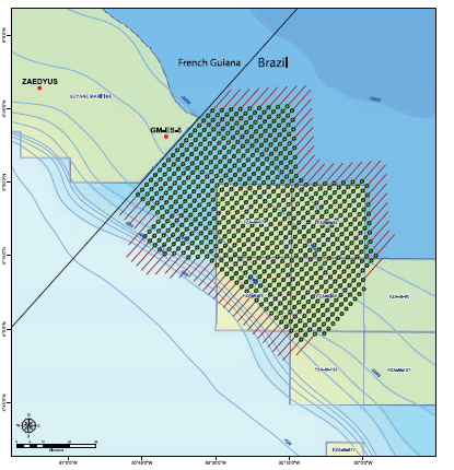
Hiner and Pedersen used 3D CSEM data collected by EMGS last August near the Zaedyus and GM-ES-5 wells. The 3D CSEM survey covered approximately 4500 km2 in a 2.5X2.5 km receiver grid. The following illustrates the survey location and layout.

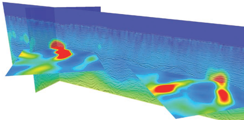
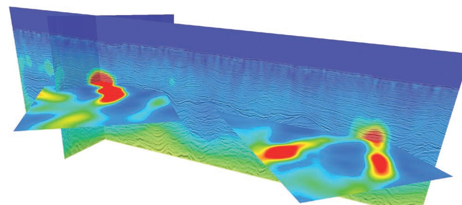
Seismic knowledge came into the picture after the CSEM inversions captured the resistivity trends of the deep-water sediments. After the deep-water data was fitted to, within the data uncertainty, the geoscientists stopped the inversion process and superimposed their resistivity cubes unto two seismic lines.
See the next figure which clearly shows portions which stand out from the background – these portions are electromagnetic EM anomalies, some of which may indicate hydrocarbon-containing fluids.

“Wildcat in known productive trend”
Lastly, the authors used an average-resistivity anomaly map to investigate the potential net rock volume of a data subset within the same CSEM survey.
After using conservative parameters in their calculations and considering the proximity of the wells in French Guiana to the CSEM-survey, and the West Africa/South America analogue; the authors suggest that the net rock volume ratio they calculated be classified as a “Wildcat in known productive trend.”