MT inversion
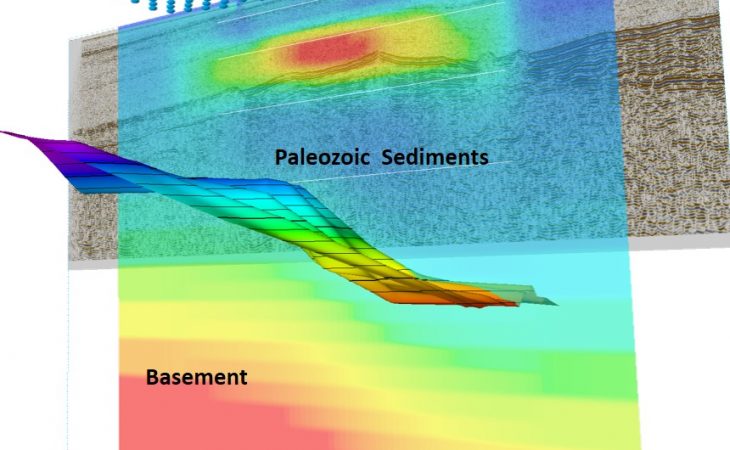
The low-frequency, deep-sensing nature of marine MagnetoTelluric (MT) surveys makes the technique well suited for mapping and interpreting regional geology, especially in salt and basalt settings.
MT measurements form an excellent complement to other geophysical data, particularly in settings where high-impedance volcanic rocks or salt make the interpretation of seismic data challenging.
Key features
- Deep imaging
- Regional mapping of large resistive structures such as salt / basalt / basement highs