Acquisition types
At EMGS we acquire CSEM and MT data according to the survey plan and in the most efficient manner. When carrying out surveys for our customers, our priorities are safety, high data quality and minimum technical downtime.
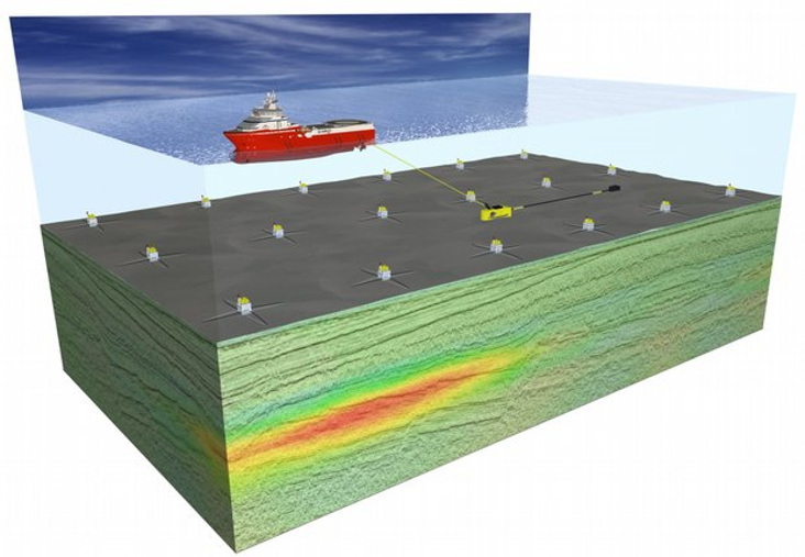
3D full-azimuth acquisition
The most common EM acquisition today are receiver grids varying from 0.5×0.5km to 3×3 km node distance depending on survey objectives. When all receivers are located on the seabed, the source is towed in a linear pattern over the grid to ensure full azimuth data. Such survey types can be used for regional mapping, prospect mapping and well placement.
2D swaths and 2D acquisition
For pilot studies or regional geological mapping, we can acquire 2D swaths or 2D regional lines. Careful survey design is needed to ensure that project objectives are met. We have acquired 2D CSEM and MT data for prospect evaluation, basalt mapping and basin evaluation.
Acquiring CSEM and MT data
Most of our surveys use a towed source for CSEM data acquisition aimed at prospect de-risking. We also offer marine MT data acquisition and joint CSEM-MT data acquisition for basin evaluation and mapping of deep structures such as e.g. basement. The unique design and sensitivity of EMGS receivers make simultaneous acquisition of CSEM and MT data possible.